Kokoda (Kokoda)
Kokoda is a station town in the Oro Province of Papua New Guinea. It is famous as the northern end of the Kokoda Track, site of the eponymous Kokoda Track campaign of World War II. In that campaign, it had strategic significance because it had the only airfield along the Track. In the decades preceding, it had been a foothills settlement near the gold fields.
Kokoda is located within the administrative divisions of Kokoda Rural LLG.
The British colonial administration found that a base for the Papuan Native Constabulary and colonial control was required to subdue the region and the government station of Kokoda was founded in 1904.
Kokoda is located within the administrative divisions of Kokoda Rural LLG.
The British colonial administration found that a base for the Papuan Native Constabulary and colonial control was required to subdue the region and the government station of Kokoda was founded in 1904.
Map - Kokoda (Kokoda)
Map
Country - Papua_New_Guinea
 |
 |
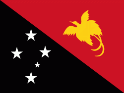
| Flag of Papua New Guinea | |
At the national level, after being ruled by three external powers since 1884, including nearly 60 years of Australian administration starting during World War I, Papua New Guinea established its sovereignty in 1975. It became an independent Commonwealth realm in 1975 with Elizabeth II as its queen. It also became a member of the Commonwealth of Nations in its own right.
Currency / Language
| ISO | Currency | Symbol | Significant figures |
|---|---|---|---|
| PGK | Papua New Guinean kina | K | 2 |
| ISO | Language |
|---|---|
| EN | English language |
| HO | Hiri Motu language |


